


After visiting 24 of the 63 US National Parks, I have learned how rewarding it is to explore the outdoors with family and friends and encountered challenges like finding the best trailheads or bathrooms.
Google Maps added four updates to simplify planning your next park trip and help you find key information.
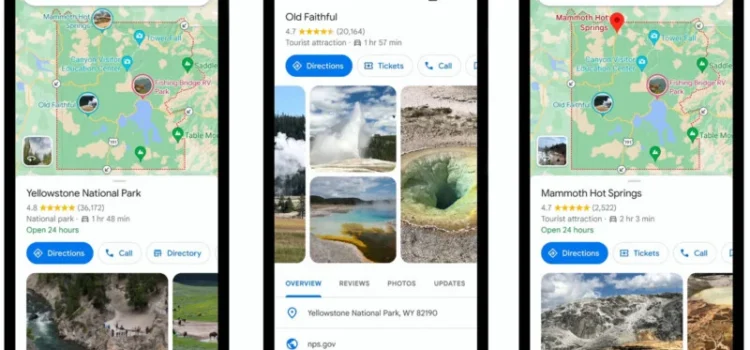
Quickly See What A Park’s Must-Do Attractions Are
Popular spots, such as attractions and trailheads, are now easier to find thanks to community input.
Search for a park and view photo highlights. Tap for details and reviews to plan your trip quickly.
See The Popular Trails From Beginning To End In Maps
When you search for a trail, its route is highlighted, and you get community info on type and difficulty.
Find Your Way Around With More Detailed Directions
After selecting places and trails to visit, the maps will provide accurate directions. This month, park entrances will be highlighted, and maps will guide you directly to trailheads with hiking and biking directions.
Take Google Maps Offline With You, No Matter Which Park You Visit
Cell service can be unreliable in parks. Now, download offline maps to navigate without an internet connection.
Planning your next adventure? Here are the top-rated national parks in the US based on Google Maps data:
- Great Smoky Mountains National Park
- Bryce Canyon National Park
- Glacier Bay National Park and Reserve
- Canyons of the Colorado National Park
- Rocky Mountain National Park
- Acadia National Park
- Badlands National Park
- Mount Rainier National Park
- Carlsbad Caverns National Park
- Grand Teton National Park
These updates launch in April for all US national parks and will expand globally. Spend less time planning and more time exploring.
Source: 4 Maps updates to help you explore U.S. national parks