


Microsoft is using artificial intelligence to address pressing challenges in US water infrastructure, focusing on leak detection, cybersecurity, and data analytics. These efforts drive the company’s commitment to becoming water-positive by 2030 returning more water to the environment than it uses while building community resilience against growing water-related risks.
These are some keyways Microsoft is using AI in the water sector:
- AI-Powered Leak Detection: Microsoft is working with FIDO tech to use AI that listens for and finds water leaks in pipe networks. This technology is being used through Water United in the Colorado River Basin to help save water and improve efficiency.
- Water Security and Cyber Security: Microsoft is helping strengthen the cybersecurity of US water utilities through the Water Utilities Pilot Program. The goal is to protect critical water services from growing cyberattacks.
- AI for Water Management (NASA Partnership): Microsoft is working with NASA to use AI tools, including Azure AI and Water Copilot, to analyze complex data from the North American Land Data Assimilation System (NLDAS-3). This helps decision-makers, such as state water agencies, manage water risks and detect contamination.
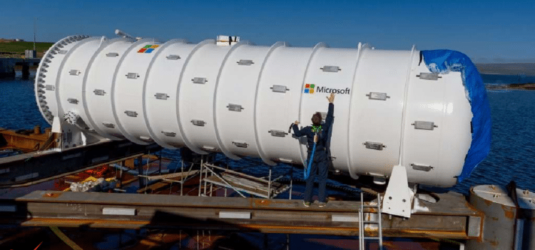
- Data Center Water Optimization: AI development consumes significant water for cooling, but Microsoft is working to reduce its impact by building new data centers with zero-water-cooling systems. These centers use closed-loop systems to use less water.
Main Project Focus Areas
- Arizona/Colorado River Basin: Microsoft is supporting the Las Vegas Valley Water District and other regions facing severe water shortages.
- Infrastructure repair. Microsoft is using AI to find small leaks, which can help prevent future water shortages.
These projects aim to make US water systems more resilient by using AI to protect infrastructure and the environment from droughts and other climate threats. The goal is to ensure reliable water access and safeguard communities.
Communities across North America face serious challenges like water shortages, flooding, and changing agricultural conditions. Recent reports show that extreme weather, especially drought, is causing major agricultural losses, while flooding remains one of the most damaging and expensive natural disasters. These problems hurt infrastructure, disrupt economies, and hit vulnerable communities the hardest. Because of this, decision-makers such as state water agencies, farmers, and urban planners need timely, detailed information to anticipate risks and adapt.
NASA has developed advanced hydrology and land-surface datasets, enabling progress in drought warning systems, environmental planning, and research. However, many potential users find them difficult to access and use due to the specialized knowledge required.
NASA and Microsoft are teaming up to make these conclusions easier to access by using AI agents powered by Microsoft Azure, OpenAI Service, and Microsoft Foundry. After the success of the Earth co-pilot demonstration, NASA’s Hydrological Sciences Lab is now developing a multi-agent co-pilot. This tool aims to help more scientists, researchers, and policymakers work with and learn from these detailed datasets.
The Usability Gap
Many organizations, such as state water agencies, emergency managers, agricultural planners, and research teams, struggle not with getting data but with having the expertise to use it. Hydrology datasets contain detailed information across many variables, each with its own units, resolutions, and processing steps. To understand things like soil moisture, drought, or flood indicators, you often need a strong background in hydrology and remote sensing.
This complexity slows scientific analysis and limits the extent to which hydrological data can be used. Useful insights that could help communities prepare for drought, manage water supplies, or predict floods often remain out of reach due to technical barriers. The challenge is to keep the science accurate while making the information easier to explore, understand, and use.
A Copilot for Hydrology
To solve this problem, NASA and Microsoft have worked together on a new multi-agent AI system that lets users interact with hydrology datasets using simple everyday language. This system builds on the NASA Earth co-pilot architecture they developed earlier, bringing trusted science, user-focused AI, and scalable cloud technology to hydrology.
Instead of browsing complex manuals or writing custom code, users simply ask the system questions like “what’s the risk?” or “show me” or “Drop stress indicators across the southern plains.” When a user asks a question, the co-pilot breaks down the request by identifying key hydrologic terms in the query, locating the relevant datasets, and determining which variables are needed. It then runs geospatial searches, interprets scientific data, and generates results in the form of maps, charts, and explanations. This process enables users to interact with the system as if they were consulting a knowledgeable hydrologist, streamlining data analysis, and making complex workflows more intuitive.
This approach makes it much easier for people to use NASA’s hydrology datasets. Now, planners, water managers, scientists, and agricultural analysts can quickly access information that previously required significant technical expertise.
NLDAS 3: A New Era of Water Intelligence
At the core of this new system is the North American Land Data Assimilation System Version 3 (NLDAS-3), one of NASA’s most advanced hydrology datasets. NLDAS-3 provides hourly data at a 1 km resolution across North and Central America, covering over 20 years of observations. Combining satellite data with advanced land-surface and hydrological models provides a detailed, continent-wide view of the water cycle.
With NLDAS3, users can examine changes in rainfall and temperature, track soil moisture and groundwater, monitor runoff and flood conditions, assess snowpack and snowmelt trends, and analyze vegetation health and evapotranspiration over time. Because it is so detailed, this dataset is extremely useful for drought monitoring, flood risk assessment, emergency planning, farming planning, and managing water resources.
NLDAS 3 offers continuous, high-resolution information across many regions and years. Organizations can use it to assess risks and make informed decisions. When combined with the AI copilot, scientific data becomes actionable insights for a wider audience.
Azure AI Behind the Scenes
The Hydrology Copilot runs on a modern Azure AI and data system designed for scientific work. Azure Synapse Analytics organizes and indexes hydrology datasets, such as NLDAS 3, making them easy and fast to search. This lets users look at decades of environmental data or current conditions in just seconds.
Azure AI Search enables the system to understand hyermology concepts and connect them to the appropriate variables and processes. Indexing NASA’s scientific documents and metadata ensures that answers are based on reliable information.
All these parts work together in Microsoft Foundry, which manages language models, multi-agent workflows, and retrieval-augmented generation pipelines. The result is a system that combines NASA’s hydrology science with Microsoft’s AI to create a smooth conversational experience.
An Appeal to Action
Water shortages, flooding, and changes in agriculture will continue affecting our environment and economy throughout the 21st century. To address these problems, we need to understand how water conditions change using clear, fast, and accurate information.
NASA has advanced hydrology datasets. Microsoft, with Azure AI, helps make these datasets more accessible and impactful for users.
This collaboration is a critical step to democratize access to hydrology insights, empowering communities to plan for the future with actionable information. As AI and cloud technology advance, transforming scientific data into impactful action will become even more effective.
If you want to see how Azure AI can help your organization use NASA’s Hydrology data for environmental resilience and water planning, contact our team. Together we can turn data into useful insights and build a stronger future for everyone.
Source: Microsoft and NASA apply AI agents to key hydrology data, deepening our understanding of Earth