






Deadly Flood Sweeps Through Nepal-Tibet Border Region
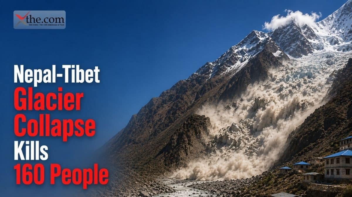
A catastrophic flood triggered by a massive glacier collapse devastated communities along the Nepal-Tibet border on August 26, 2026, killing at least 160 people and leaving hundreds more missing. The disaster struck without adequate warning, engulfing entire villages and destroying critical infrastructure in one of the deadliest natural disasters to hit the Himalayan region in years.
Initial reports from the Nepalese government confirmed that the flood was caused by the collapse of a glacier in the high Himalayas, which sent a massive volume of water, ice, and debris roaring down river valleys at tremendous speed. The resulting surge reached villages within minutes, giving residents almost no time to evacuate.
Rescue operations have been severely hampered by the remote terrain, damaged roads, and ongoing risk of secondary landslides. Military helicopters from both Nepal and India have been deployed to assist with evacuation and relief efforts.
Satellite imagery captured before and after the disaster shows the dramatic scale of the flooding. Vast areas of previously green valleys were reduced to barren mudflows, with entire villages erased from the landscape. The debris field extends for miles downstream from the collapse site.
Communication networks in the affected area were severely disrupted, with cell towers destroyed and internet connectivity severed. Emergency responders relied on satellite phones and military communication systems to coordinate rescue efforts in the initial hours after the disaster.
What Caused the Disaster
Geologists and climate scientists believe the glacier collapse was triggered by a combination of factors including rising temperatures, glacial lake formation, and structural weakening of ice formations due to climate change. The region has experienced above-average temperatures throughout the summer of 2026.
The glacier in question had been monitored for signs of instability, but the speed and scale of the collapse exceeded projections. A seismograph station registered what initially appeared to be a 5.2 magnitude earthquake, but experts later determined the seismic signature was consistent with a massive landslide rather than tectonic activity.
The flood waters carried enormous quantities of sediment, boulders, and uprooted trees, destroying everything in their path. In some areas, the debris flow reached depths of over 30 feet, burying homes, roads, and farmland under meters of rock and mud.
Rescue and Relief Operations
The Nepalese Army, along with police and local disaster response teams, launched immediate search and rescue operations. However, accessing the affected areas proved extremely challenging due to the destruction of road networks and bridges.
Indian military helicopters joined the rescue effort within hours, airlifting injured survivors and delivering emergency supplies including food, water, blankets, and medical equipment. The United Nations Office for the Coordination of Humanitarian Affairs has mobilized international aid.
Temporary shelters have been established in nearby towns for displaced families. Emergency medical teams have set up field hospitals to treat the injured, many of whom suffered crush injuries, hypothermia, and waterborne illness from the contaminated flood waters.
As of August 29, the death toll continues to rise as rescue workers reach more affected communities. The full extent of the devastation is expected to become clearer in the coming days as access improves.
The World Health Organization has deployed emergency medical teams to assist with treating the injured and preventing disease outbreaks. Contaminated flood waters create significant risks of waterborne illness, including cholera, dysentery, and skin infections.
The economic cost of the disaster is estimated to exceed $500 million, a devastating blow to a country where per capita income remains among the lowest in Asia. Reconstruction of destroyed infrastructure alone is expected to take years.
Climate Change Connection
Scientists have long warned that Himalayan glaciers are among the most vulnerable to climate change. A 2024 report from the International Centre for Integrated Mountain Development found that Himalayan glaciers have lost approximately 15 percent of their ice mass since 1970.
The formation of glacial lakes, which occur when melting ice creates reservoirs behind natural dams of debris, presents an acute risk. When these dams fail, the resulting floods can be catastrophic, carrying volumes of water and debris that dwarf anything a typical river system can handle.
Nepal sits in one of the most seismically active and climatically vulnerable regions on Earth. The combination of tectonic activity, extreme terrain, and accelerating glacial melt creates a perfect storm of natural hazard risk that will likely intensify as global temperatures continue to rise.
Climate researchers emphasize that events like this glacier collapse are becoming more frequent and more severe as the planet warms. Without significant global action to reduce greenhouse gas emissions, similar disasters in mountain regions worldwide are expected to increase in both frequency and intensity.
Satellite monitoring of Himalayan glaciers has revealed an acceleration of ice loss over the past decade. Research published in Nature Climate Change found that the rate of glacial retreat in the Himalayas has doubled since 2000, with some glaciers losing over 50 percent of their ice mass.
International climate adaptation funding for mountain regions remains inadequate. A 2025 report by the United Nations Environment Programme estimated that Himalayan nations need at least $2 billion annually in climate adaptation investment, but actual funding flows are less than 10 percent of that amount.
Impact on Local Communities
The affected region is home to several small farming and herding communities that depend on the river valleys for agriculture, livestock grazing, and transportation. The flood destroyed hundreds of homes, livestock, and the agricultural land that sustains local livelihoods.
Schools, health clinics, and community buildings have been destroyed or severely damaged, creating an urgent need for reconstruction even as rescue operations continue. The economic impact on communities that were already among the poorest in Nepal will be devastating.
Many residents have lost family members, homes, and everything they owned. The psychological impact of the disaster, combined with the long process of rebuilding, will affect these communities for years to come.
International aid organizations have launched emergency fundraising campaigns to support relief and reconstruction efforts. The World Bank and Asian Development Bank have indicated they will provide emergency financing for disaster recovery and climate resilience infrastructure.
Tribal communities in the affected region have lived in the Himalayan valleys for centuries, developing sophisticated knowledge systems for managing natural hazards. However, the scale and speed of climate-driven disasters are overwhelming traditional coping mechanisms.
Nepal government has declared a state of emergency in the affected districts and allocated emergency funds for immediate relief. Prime Minister visited the disaster zone on August 28, pledging that reconstruction would be a national priority.
The Bigger Picture: Himalayan Glacial Risk
The Nepal-Tibet disaster is a stark reminder of the growing threat posed by climate-driven glacial instability in mountain regions around the world. Similar risks exist in the Andes, the Alps, and other glaciated mountain ranges.
Governments and international organizations are increasingly recognizing the need for early warning systems, climate adaptation infrastructure, and community preparedness programs to mitigate the impact of future glacial disasters.
For the people of the Nepal-Tibet border region, the immediate priority is rescue, relief, and recovery. But the longer-term challenge is building resilience against a changing climate that will continue to reshape the landscape and threaten communities for decades to come.
China has offered to share glacial monitoring data and satellite imagery with Nepal to improve disaster prediction and early warning capabilities. The cooperation represents a positive development in bilateral relations between the two countries.
Disaster preparedness experts emphasize that investment in early warning systems, evacuation planning, and community resilience training can significantly reduce the death toll from future glacial flood events. The Nepal-Tibet disaster provides painful but valuable lessons for disaster risk reduction worldwide.
SOURCES